INDIAN ARMED FORCES CHIEFS ON OUR RELENTLESS AND FOCUSED PUBLISHING EFFORTS

The insightful articles, inspiring narrations and analytical perspectives presented by the Editorial Team, establish an alluring connect with the reader. My compliments and best wishes to SP Guide Publications.
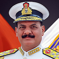
"Over the past 60 years, the growth of SP Guide Publications has mirrored the rising stature of Indian Navy. Its well-researched and informative magazines on Defence and Aerospace sector have served to shape an educated opinion of our military personnel, policy makers and the public alike. I wish SP's Publication team continued success, fair winds and following seas in all future endeavour!"

Since, its inception in 1964, SP Guide Publications has consistently demonstrated commitment to high-quality journalism in the aerospace and defence sectors, earning a well-deserved reputation as Asia's largest media house in this domain. I wish SP Guide Publications continued success in its pursuit of excellence.
- Appointments Committee of Cabinet approves one-month extension in service of Chief of the Army Staff
- Admiral Dinesh K. Tripathi assumes Command of the Indian Navy as 26th Chief of the Naval Staff
- Prime Minister witnesses 'Bharat Shakti' – a Tri-Services Firing and Manoeuvre Exercise in Pokhran, Rajasthan
- Interim Defence Budget 2024-25 — An Analysis
- Union Defence budget 2024
- Prime Minister Modi Commemorates Indian Navy Day in a Grand Ceremony
Geographic information system
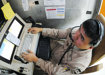
While generally this data has been assumed to pertain to terrain features only, a true GIS ready map should logically cover the complete spectrum of data required by various disciplines of geodetic science.
Rapid advancements in geographic information system (GIS) and global positioning system (GPS) have made it possible to correlate and use diverse map information at the click of a mouse. The integration of all efforts pertaining to geospatial data and intelligence between the three services is a necessary step towards fielding a fully functional C4I2 System, which would be an integral part of our combat capacity building in the years ahead. No automated battlefield management system (BMS) can be fully exploited unless quality data is provided to it as input. Our efforts to enable production of geospatial intelligence would meet most of the data requirements of both C4I2 as well as Tac C3I systems of the military. The capability of any application based on a GIS is limited to the quantity and quality of data provided as the input.
A digitised cartography map needs a huge amount of attribute data before it can become suitable as GIS input. While generally this data has been assumed to pertain to terrain features only, a true GIS ready map should logically cover the complete spectrum of data required by various disciplines of geodetic science. This definitely calls for inputs even from agencies other than those dealing with topographic survey.
The effect of certain type of munitions like incendiary, chemical or biological cannot be calculated purely by use of standard two dimensional models. These area weapons used by the enemy in the tactical battle area (TBA) require detailed knowledge of terrain, for example, in terms of type of forests, condition of shrubs, undergrowth and meteorological conditions. For an operational information system (OIS) like an automated BMS, geospatial data is a vital element of information. Geospatial data plays a crucial role in maintaining the updated situational picture in terms of geographical location of elements of own and enemy forces between all users in the battlefield at all times. At the same time, today’s dynamic battlefield having diverse users calls for exchange of positional information between systems using different scales of maps, imagery from different airborne sensors, different map projections and the like.
Additionally, modern-day precision weapons and munitions need much more accuracy for pinpoint targeting in all types of maps, including small and medium scaled ones, than required for majority erstwhile majority area weapons. It is, therefore, essential that the precise location of own and enemy forces/targets down to individual soldier/weapon platform are constantly maintained. Additionally, whether we consider a situation of counter-insurgency, disaster management or communal riots, the disparate information held by different agencies has to be fused to form an intelligence picture before operations can be planned to optimise success.
At the apex level of NCW, the first prerequisite would be the fusion of inputs from the three services pertaining to the defence part of the national security apparatus. While the services may not be able to influence smoother flow of information from other arms of the government (till the political hierarchy enforces it), there is a need to commence the integration of information belonging to the three services under the aegis of HQ IDS, also ensuring integration of topographical data.
In the absence of a dedicated defence space programme, the military is dependent on the NRSA and commercial satellite based imagery for some of the IMIMNT requirements. There is a need to employ other alternate sensors to meet defence requirements not only pertaining to imagery, but also pertaining to data required for cartography. This calls for a well coordinated surveillance effort by airborne sensors of the three services. Similarly, the HUMINT and ELINT data needs to be fused with IMINT and the topographical data. Military survey needs a large amount of data to prepare accurate maps of areas across the IB/LC/LAC. Unless all the available assets are tasked according to the overall vision for geospatial intelligence, agencies and organisations will continue to operate in isolation and required geospatial data will remain in critical short supply. At national level the National Technical Research Organisation (NTRO) and the National Spatial Data Infrastructure (NSDI) have come up but NSDI deals with only ‘some’ aspects pertaining to creation of metadata from available geospatial data and does not cater for inputs from the intelligence community or for that matter the defence services, which is a major flaw. In the military, the Defence Intelligence Agency (DIA) within HQ IDS is the central repository for all intelligence inputs of military including IMINT and ELINT but aspects of topography are yet to be integrated with DIA. Also, adequate resources in terms of remote sensing, ELINT payloads and cartography are not available to produce high quality fused data. The bottom line is that Indian military today needs an enterprise GIS post-haste.


