


The insightful articles, inspiring narrations and analytical perspectives presented by the Editorial Team, establish an alluring connect with the reader. My compliments and best wishes to SP Guide Publications.

"Over the past 60 years, the growth of SP Guide Publications has mirrored the rising stature of Indian Navy. Its well-researched and informative magazines on Defence and Aerospace sector have served to shape an educated opinion of our military personnel, policy makers and the public alike. I wish SP's Publication team continued success, fair winds and following seas in all future endeavour!"

Since, its inception in 1964, SP Guide Publications has consistently demonstrated commitment to high-quality journalism in the aerospace and defence sectors, earning a well-deserved reputation as Asia's largest media house in this domain. I wish SP Guide Publications continued success in its pursuit of excellence.
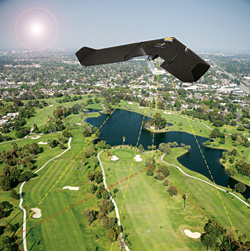
Aerial survey company Bluesky has launched a fast response aerial survey service using state of the art unmanned aerial vehicles (UAV) or drones. The technology, originally developed by the military, includes Artificial Intelligence (AI) guided autopilot, high resolution integrated camera and environmentally friendly rechargeable propulsion system. Autonomous take-off and landing ensures the system is easy to use and with a wingspan of less than a metre it can be easily transported without the need for complex assembly.
“Using UAV’s we can respond quickly to demands to collect site specific images and data in a very cost effective way,” commented James Eddy, Technical Director at Leicestershire-based Bluesky. “The integrated camera captures high resolution photogrammetric images that can be used to create map accurate aerial survey data including height models. The system is compact and lightweight making it easy to store and transport and can be launched by hand from virtually any location. Flight planning software and an Artificial Intelligence-guided autopilot make it easy to control and the system will gently and safely return to the ground with a single touch of a button.”